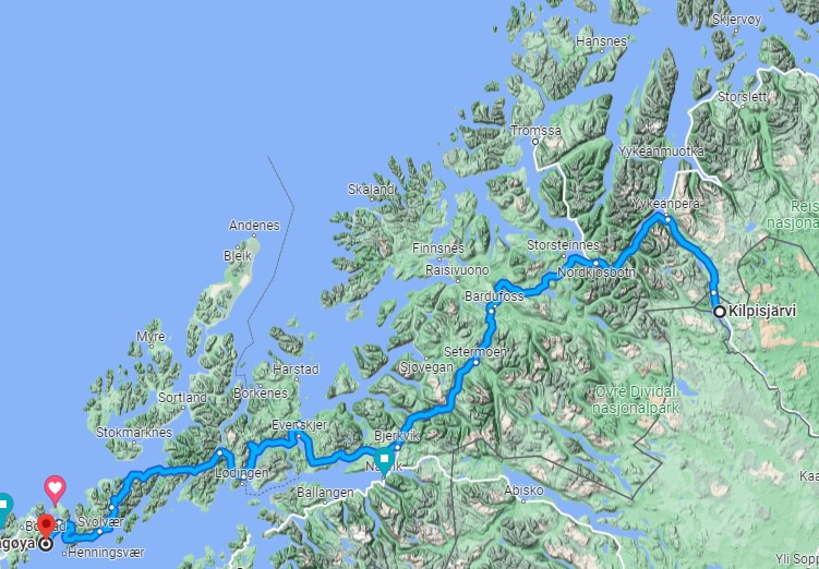
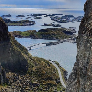
Lofoten is an archipelago located in the county of Nordland, Norway. Situated above the Arctic Circle, Lofoten is known for its breathtaking natural beauty - towering granite mountains, dramatic landscapes - especially with the Northern Lights (Aurora Borealis), and picturesque fishing villages.
“Austvågøya is the northeasternmost and largest of the larger islands in the Lofoten archipelago in Nordland county, Norway. It is located between the Vestfjorden and the Norwegian Sea. The island of Vestvågøya lies to the southwest and the large island of Hinnøya to the northeast. In 2017, the island had about 9,000 residents.” Wikipedia
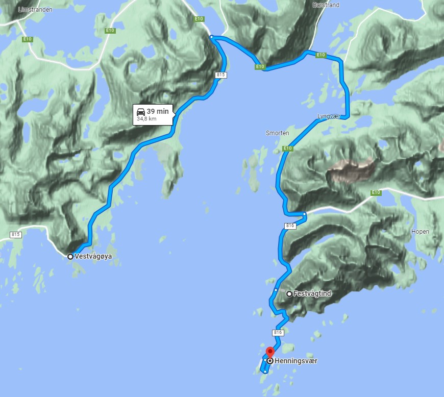
Places like Reine, Henningsvær (lofoottien venetsia). Note that Moholmen Lighthouse is located to east from Henningsvær. Nusfjord (ks. blogi), (maps) are known for their picturesque red and yellow wooden houses, quaint harbor settings, and vibrant fishing culture. Visitors can learn about the traditional methods of fishing, visit local fish markets, and even sample delicious seafood delicacies.
Some Hiking Routes
- northadviser.com, hiking routes at Lofoten.
- Hiking routes on map: www.outdooractive.com
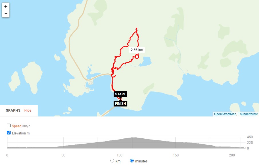
- Festvågtind
- Justadtinden
- Challenging! Beware! Vågakallen
- Offersøykammen
- outdooractive: “Offersøykammen is located at 436 meters above sea level”, see getting there.
- see trail on top of Google maps here
- 68north.com maps
- Hyten, northadviser.com
Some of the popular beaches:
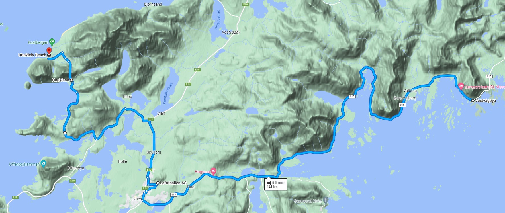
- Haukland Beach (Google Maps)
- Considered one of the most beautiful beaches in Lofoten, Haukland Beach is located a short drive from Lyngvær (about one hour). It boasts powdery white sands, crystal-clear turquoise waters, and stunning mountain backdrops. It’s an ideal spot for a leisurely stroll: “Gentle steps in stride, Nature’s beauty by my side, Leisurely stroll’s pride.”
- Uttakleiv Beach Google Maps
- a similar stunning setting as Haukland Beach. It is known for its striking rock formations and panoramic views of the ocean.
- weather, yr.no
- Kvalvika Beach Google Maps
- Hiking: 68north.com: “Located in an isolated bay on the northern side of Moskenesøy and only reached by foot, Kvalvika feels as though it could be at the edge of the world, not an easy hour’s walk.”
- marikaworld
- weather yr.no
Valberg
The municipality of Valberg was created by an acrimonious split from the municipality of Borge in 1927. The new municipality initially had 625 residents. During the 1960s, there were many municipal mergers across Norway due to the work of the Schei Committee. On 1 January 1963, Valberg municipality (population: 662) was merged with the neighboring municipalities of Borge (population: 4,056), Buksnes (population: 4,416), and Hol (population: 3,154) to create the new Vestvågøy Municipality. Current weather at Valberg.
- Valberg church
- Tiltaltti, Common chiffchaff, (Phylloscopus collybita) youtube. Laulu yleisesti tunnettu ”til-talt” -tiputtelu. Luontoportti ja siten Tiltaltin nimitys on onomatopoeettinen. Katso myös tilitaltti.
must-see attractions and things to do
near Borg
- Trail to about 370m Hoven starts either by the campsite or by the golf course. (maps)
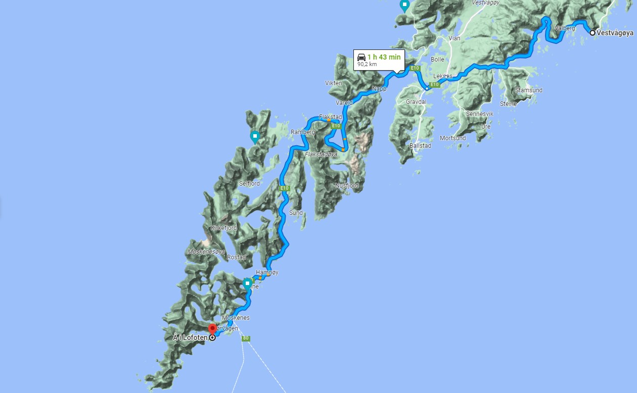
- Reine: Although it’s a bit further away from Borg, Reine is often considered one of the most beautiful villages in Lofoten. Its iconic red and yellow fishing huts, framed by majestic mountains and crystal-clear waters, create a postcard-perfect setting. Make sure to visit the nearby Reinebringen viewpoint for a stunning panoramic view of the village and its surroundings.
- Eggum: A short drive from Borg, Eggum is a picturesque coastal village with rugged cliffs and sweeping ocean views. Hvit strand - Eggum - maps
- Unstad beach: go and watch the surfers catch waves.
- The Lofotr Viking Museum in Borg (maps): explore a reconstructed chieftain’s house and learn about the region’s Viking heritage.
near Lyngvær
- Leknes: Since Lyngvær is close to Leknes, you might want to explore this larger town. Leknes offers various amenities, including shops, restaurants.
- Ballstad is a charming fishing village located nearby. It offers a glimpse into the traditional fishing culture of Lofoten.
- Nusfjord: Nusfjord is a historic fishing village that has been well-preserved and is now a designated UNESCO World Heritage Site.
- Lofoten Aquarium: Located in Kabelvåg, which is a short distance from Lyngvær (15 minutes drive, see maps)
- Torsfjord is a scenic fjord located close to Lyngvær. It offers beautiful views of steep mountains, cascading waterfalls, and tranquil waters. Exploring the fjord by boat or taking a leisurely hike, see PDF and in Mapcarta
On the road again
- Museot kartalla
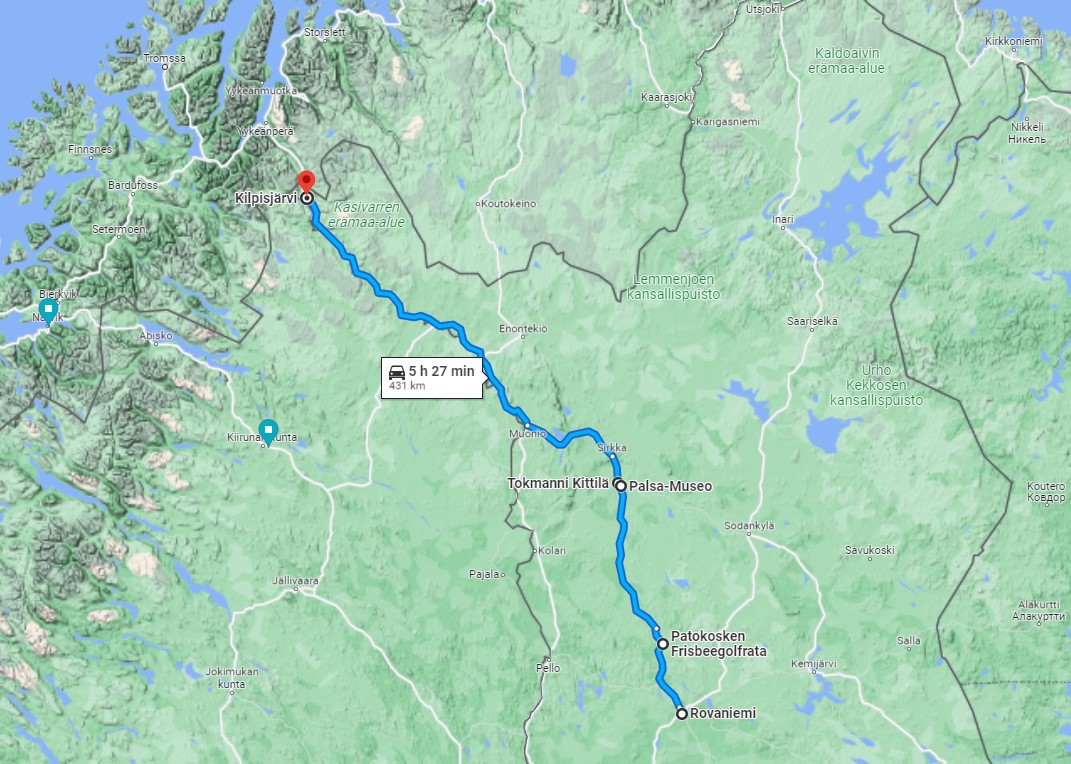
- Kittilä
- Särestöniemi-museo: 12-18, “Taidemaalari, professori Reidar Särestöniemen (1925- 1981) taiteilijakoti Kittilässä”
- Palsa-museo: 12-18
- Samiland: 10-18
- sää, foreca.fi
- Kilpisjärvi
- maps: Tsahkalputous
- maps: K-Market Kilpishalli
- Saana:
- Reitti Saanatunturille on 4 kilometriä pitkä. Aikaa huiputukseen on hyvä varata nelisen tuntia. Reitin lähtöpiste sijaitsee Kilpisjärven Retkeilykeskuksen pihassa.
- retkipaikka.fi, blogi
- kohteenamaailma.fi, blogi
- Saanajärvi
- luontoon.fi, Saanan polku
- Sää:
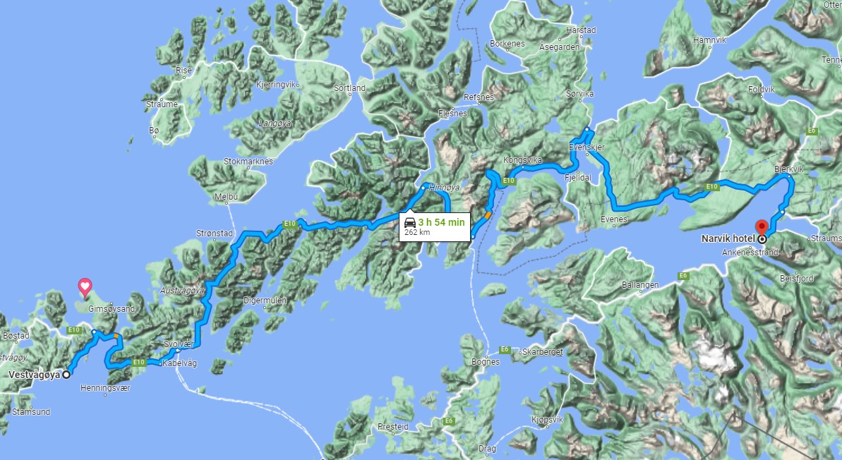
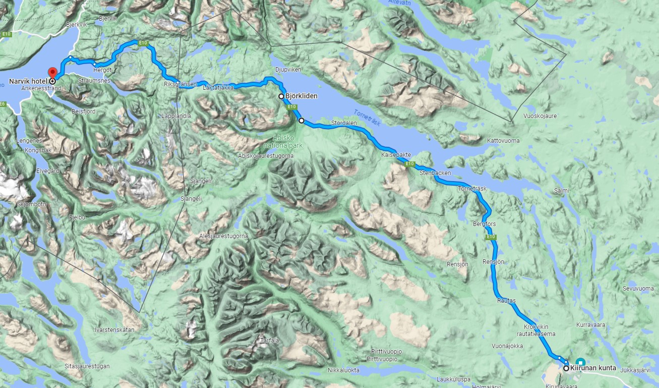
- Narvik, Norway: Narvik is a scenic town located on the shores of the Ofotfjord. It is known for its stunning mountainous surroundings and the Narvik War Museum (open 10-16), which provides insight into the town’s role in World War II.
- Abisko, Sweden: As you cross the border into Sweden, you’ll find Abisko National Park. This pristine wilderness is renowned for its dramatic landscapes, including towering mountains, deep valleys, and the stunning Lake Torneträsk.
- Aurora Sky Station: Lifts open daily, Evenings: June 17, 2022 – July 17, 2022 (Every day during the week)
- Kiruna is a fascinating town in northern Sweden and the northernmost city in the country. It is famous for its iconic Icehotel, where you can spend the night in a room made entirely of ice and snow. The Kiruna Church, with its unique architecture, is also worth a visit. Additionally, you can explore the nearby Kiruna Mine, one of the largest iron ore mines in the world.
Language tips
- Unnskyld meg, snakker du engelsk? (Excuse me, do you speak English?) This is a useful question to ask if you need help or directions and are unsure if the person you are speaking to speaks English.
- Kan jeg få en [øl/vann/kaffe]? (Can I have a [beer/water/coffee]?) If you’re at a restaurant or café, this is a useful phrase to know when you want to order something to drink.
- “Hvor er nærmeste bensinstasjon?” This translates to “Where is the nearest gas station?”
- “Jeg har gått meg bort” tai “Jeg har mistet meg” (kirjaimellisesti “Olen kadottanut itseni”).
Other stuff
- Frisbeegolf
- Tenk Lofoten Frisbeegolfbane (Leknes)
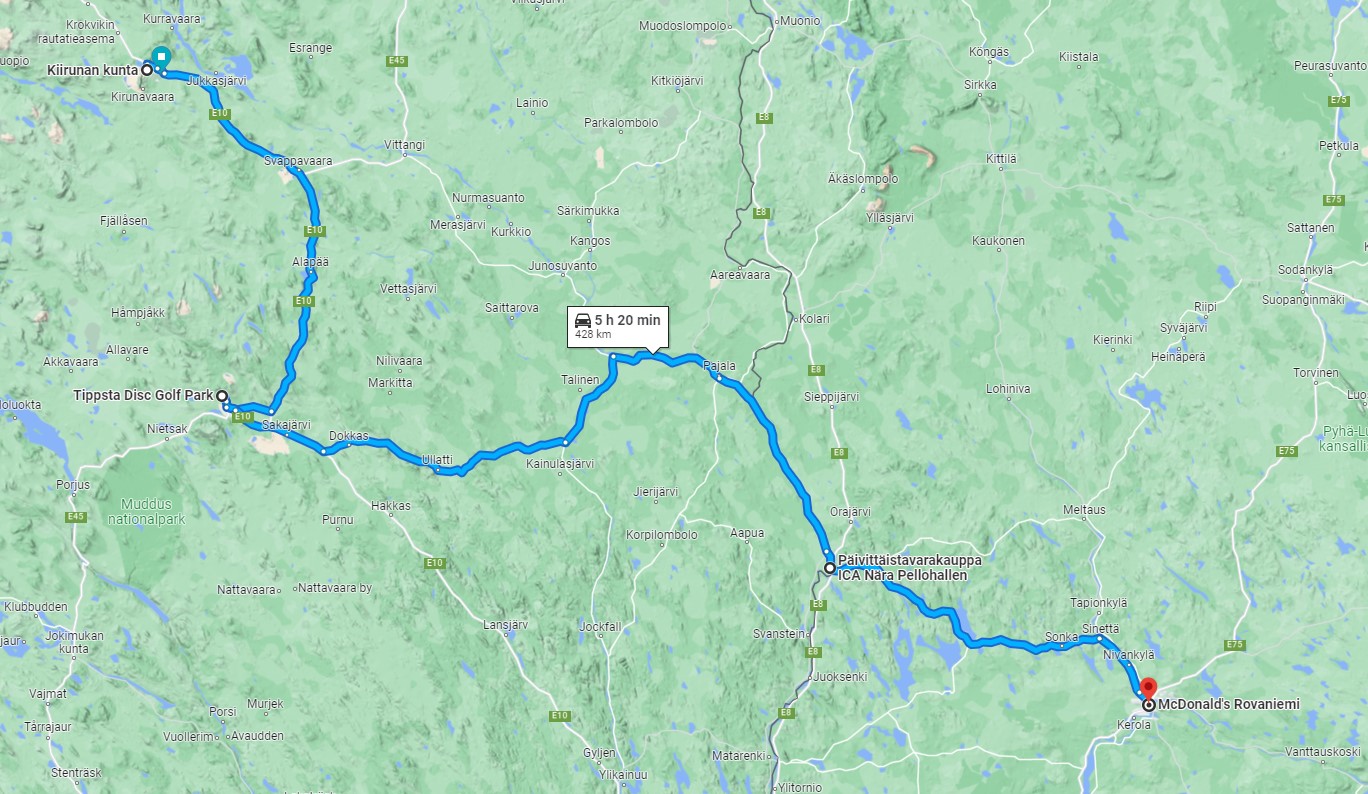
- Discgolf Kiruna
- Frisbeegolfia Norjassa, youtube
- Hermannsvika Frisbeegolfbane, udisc
- Mapcarta
- Kalastus
- kalastus lofooteilla
- turskaa ja seitä
- Turskan kalastus rannalta - Kalassa.net
- näin kalastetaan turskaa veneestä - youtube
- Alkoholi
- “Norja ei ole EU-maa. Menomatkalla alkoholia saa viedä mukanaan: 1 litra väkeviä + 3 litraa viiniä + 2 litraa olutta. Jos viet Norjaan pelkästään olutta, mukana saa olla korkeintaan 19 tölkkiä (6,5 litraa).” Autolla Norjaan – vinkit ja kokemukset - Kerran elämässä
- toll.no
- Kirjat
- Merikirja nostattaa kaipuun Lofooteille
Apps
- Karttaselain
- ut.no
- Oruxmaps (offline kartat)
- Mapitare
- hvor
- norgeskart (Google play)
- tracker
Links
Norway links
- 04/2024: “Rahaton paratiisi” HS 7.4.2024: “Yli miljoona turistia matkustaa Lofooteille joka vuosi.”
- Lofoten: private ta.dm
- The average temperature in Lofoten in June is around 12°C (54°F), and the sun never sets, which means you’ll have plenty of daylight hours to explore the islands.
- Norway ta.dm
- Hamningberg
- Varanger
- Varanger tourist route
- Vestre Jakobselv, Annijoki. Annejohkalla tarinaa
- Klubbnasen
- Lohta Annijoelta
Abisko
Abisko, Sweden, is a small village located in the northern part of the country, within the Lapland region. It is situated approximately 195 kilometers (121 miles) northwest of Kiruna, one of the major towns in Swedish Lapland. Short hiking at Abisko (private sp). See trails on the map - www.naturkartan.se.
Frisbeegolf (discgolfparken)
- Gällivaara
Driving